Land navigation in search and rescue involves the systematic process of locating, reaching, and guiding individuals or groups who are lost, stranded, or in distress in wilderness or rural environments. Land navigation in SAR is both an art and a science, requiring not only knowledge of navigation techniques but also adaptability, problem-solving under stress, and teamwork. It’s an essential skill set for ensuring the safe return of those in distress.
Preparation
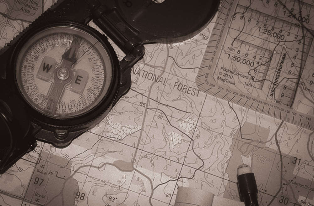
Map and Compass Use. Understanding how to read topographic maps and use a compass is fundamental. SAR teams use these tools to plot routes, understand terrain, and navigate through areas without modern navigation aids.
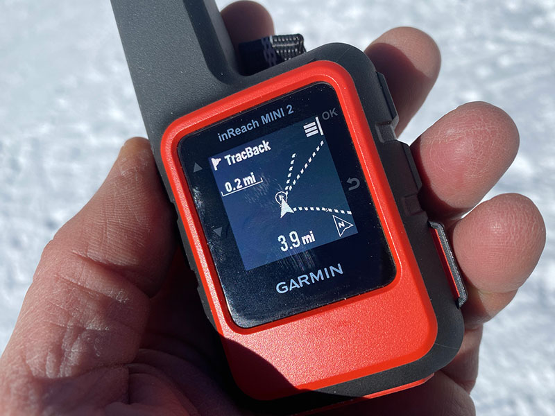
GPS and Modern Tools. Many teams now complement traditional methods with GPS devices, satellite communicators, and mapping apps. These tools provide real-time location tracking, but SAR personnel are trained to rely on map and compass in case of technology failure.
Route Planning. Before heading out, SAR teams plan the search area, considering terrain, weather, and the profile of the person or group lost (e.g., their likely speed of movement, experience level).
Navigation Techniques
Dead Reckoning. Estimating current position based on a previously known position, direction, and speed of travel.
Terrain Association. Using recognizable land features to guide movement, comparing what’s seen with what’s on the map.
Resection / Triangulation. Locating one’s position by sighting at least two known landmarks on the map.
Challenges
Harsh conditions can obscure landmarks, affect visibility, and change terrain, complicating navigation. Nighttime navigation or against the clock can add urgency and stress to the operation. Dense forests, rugged mountains, or vast open areas without distinct features can make navigation difficult.
Communication
SAR teams maintain constant communication with each other and a base of operations, often using radios or satellite phones. This coordination helps in adjusting search patterns, relaying found information, or calling for additional resources.
Technology is amazing until it isn’t.
SAR teams use GPS, Starlink, and specialized apps to navigate and track locations, but sometimes these wonderful aids fail.
When batteries die, the internet fails, and blackouts make technology less useful, nothing beats old-fashioned map-and-compass skills. VCSAR1 regularly practices its use of low-tech techniques to ensure readiness even when the lights go out.